Space Intelligence
Space Intelligence
with spatial intelligence
with spatial intelligence
with spatial intelligence
Continuous monitoring of critical assets. Manage operational risks and anticipate threats with satellite imagery and geospatial AI for mining, energy, carbon, and critical infrastructure.
Continuous monitoring of critical assets. Manage operational risks and anticipate threats with satellite imagery and geospatial AI for mining, energy, carbon, and critical infrastructure.
Continuous monitoring of critical assets. Manage operational risks and anticipate threats with satellite imagery and geospatial AI for mining, energy, carbon, and critical infrastructure.
Trusted by
Trusted by
NOR ASSET & TERRITORY Intelligence
More assets and territories monitored with the same team.
More assets and territories monitored with the same team.
More assets and territories monitored with the same team.
More assets and territories monitored with the same team.
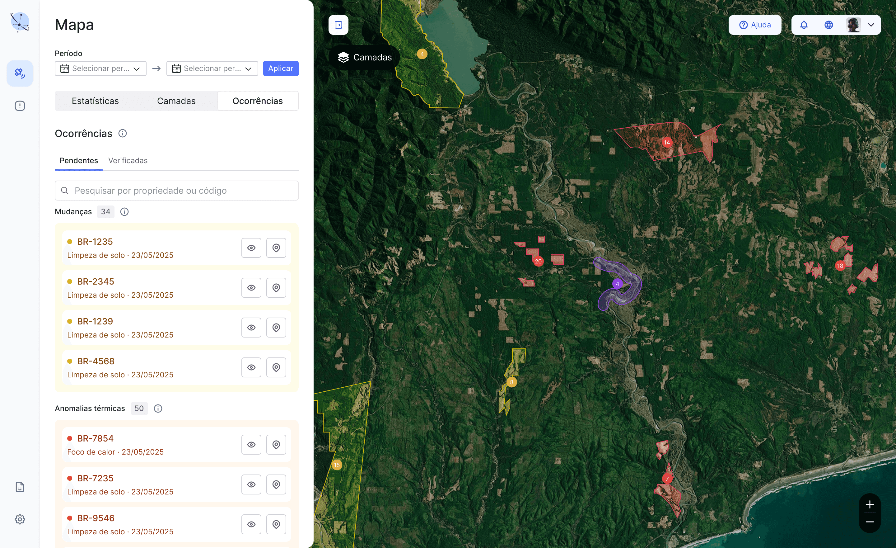
Detection & Continuous Monitoring with AI
Detection & Continuous Monitoring with AI
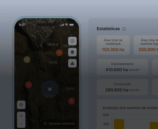
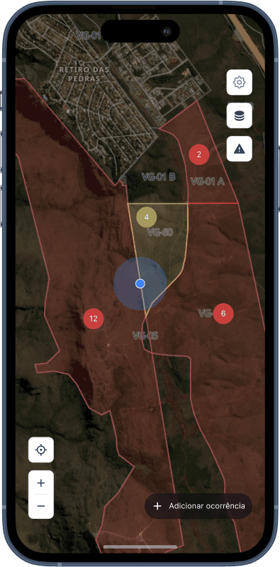
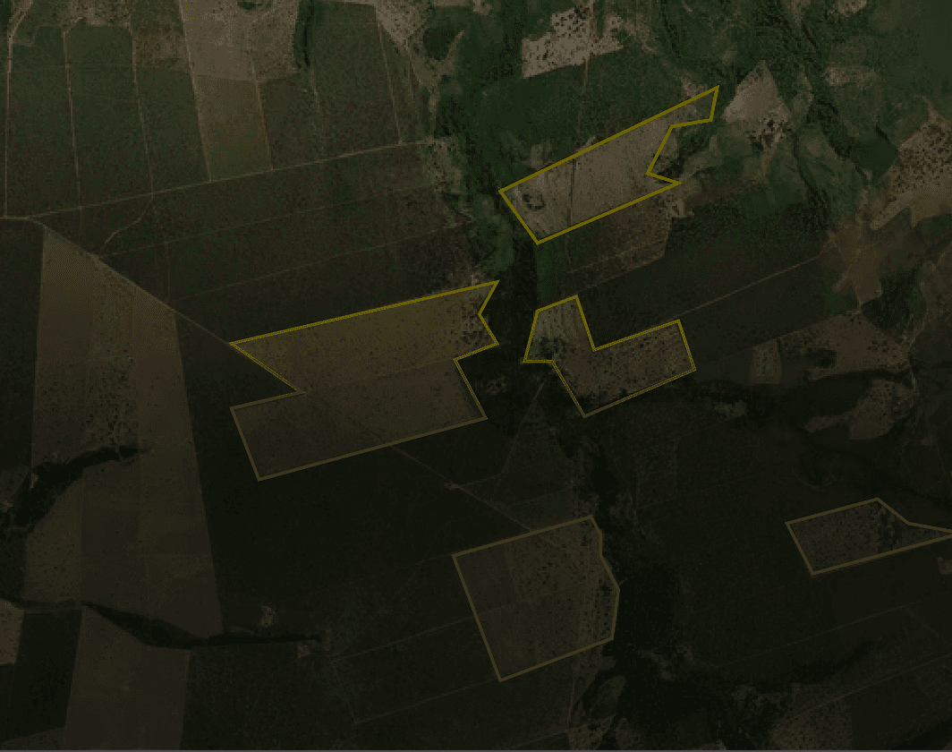
The system uses satellites and Artificial Intelligence to continuously monitor sensitive areas, issuing precise, georeferenced alerts about threats (such as deforestation, wildfires, and encroachments) to enable immediate action.
The system uses satellites and Artificial Intelligence to continuously monitor sensitive areas, issuing precise, georeferenced alerts about threats (such as deforestation, wildfires, and encroachments) to enable immediate action.
Detection & Continuous Monitoring with AI
The system uses satellites and Artificial Intelligence to continuously monitor sensitive areas, issuing precise, georeferenced alerts about threats (such as deforestation, wildfires, and encroachments) to enable immediate action.
Standardized Reports & Compliance
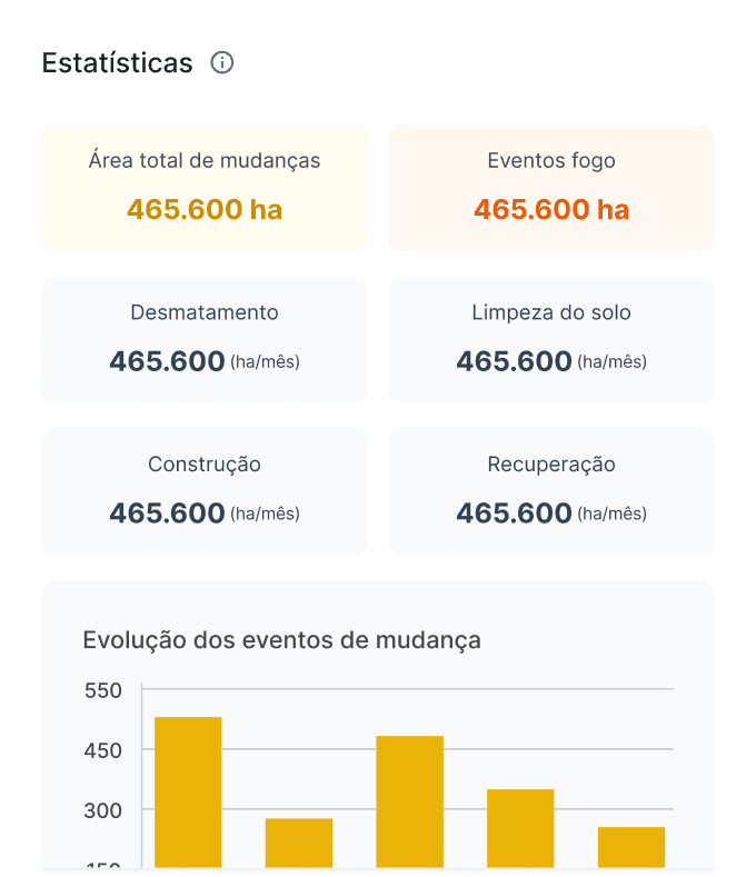
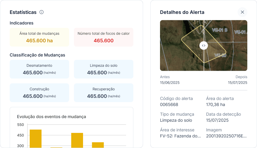
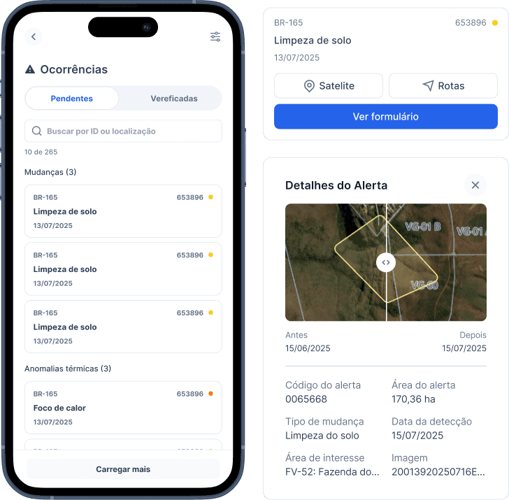
The system’s edge is turning every detection into a complete, auditable incident report, creating a standardized workflow from alert to threat resolution, including field team support via mobile app.
The system’s edge is turning every detection into a complete, auditable incident report, creating a standardized workflow from alert to threat resolution, including field team support via mobile app.
Standardized Reports & Compliance
The system’s edge is turning every detection into a complete, auditable incident report, creating a standardized workflow from alert to threat resolution, including field team support via mobile app.

OPEX Reduction with Intelligence
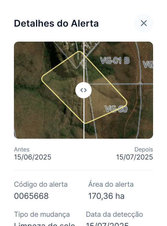
The system combines satellite monitoring with AI and operational management. It detects threats, generates automatic reports, and directs field teams via the app to the most urgent incidents, ensuring fast response and reduced costs.
The system combines satellite monitoring with AI and operational management. It detects threats, generates automatic reports, and directs field teams via the app to the most urgent incidents, ensuring fast response and reduced costs.
OPEX Reduction with Intelligence
The system combines satellite monitoring with AI and operational management. It detects threats, generates automatic reports, and directs field teams via the app to the most urgent incidents, ensuring fast response and reduced costs.
NOR carbon intelligence
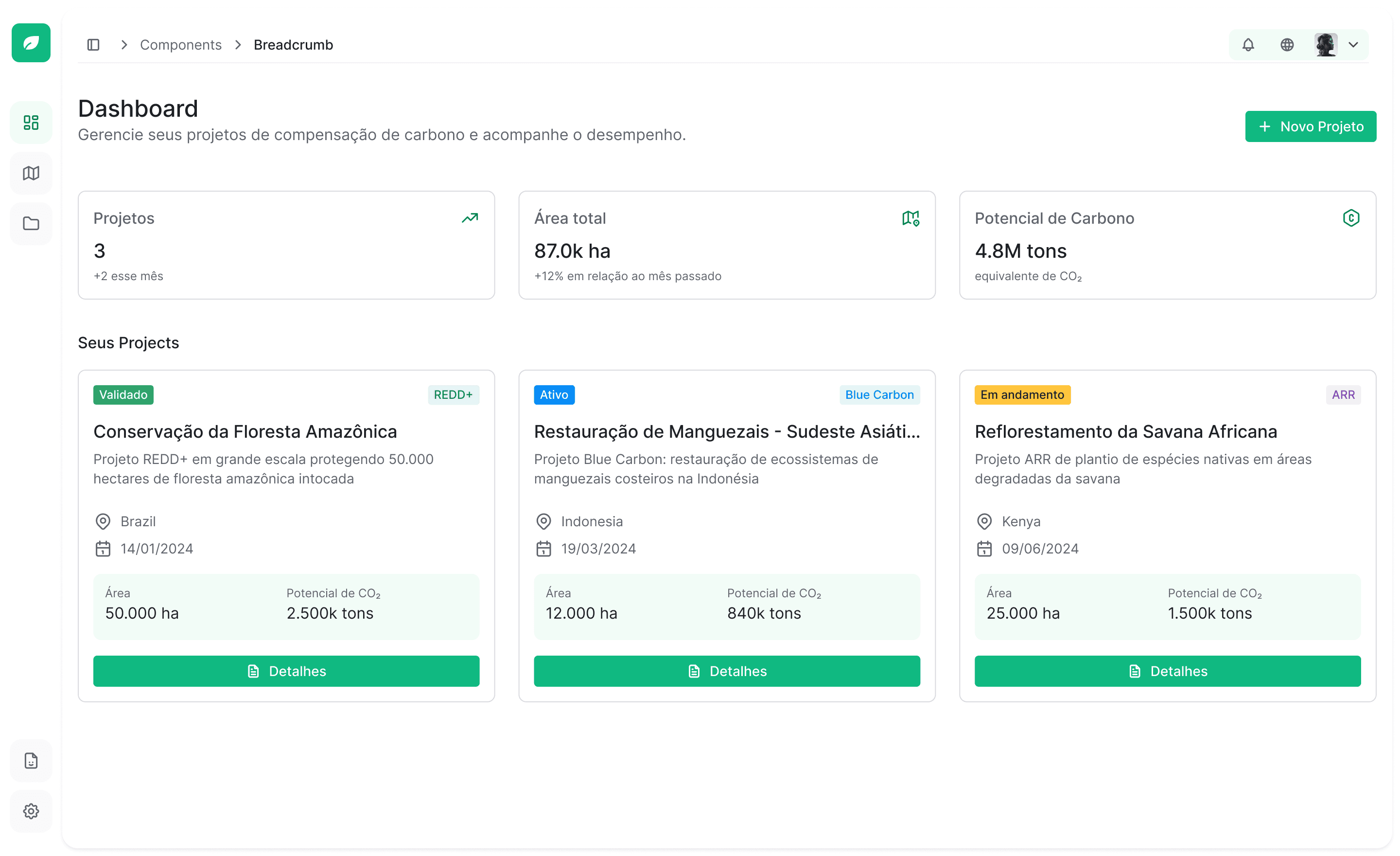
Potential analysis, digital MRV, and NBS project management on a single platform.
Potential analysis, digital MRV, and NBS project management on a single platform.
Potential analysis, digital MRV, and NBS project management on a single platform.
https://www.contribute.io
https://www.contribute.io
https://www.contribute.io
Territorial Integrity and
Due Diligence
Socio-environmental due diligence in seconds
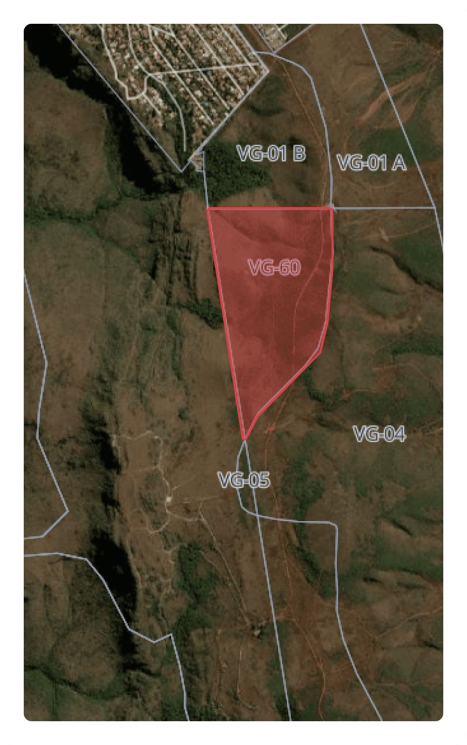
Overlap with CAR, protected areas, indigenous lands, and embargoed areas. Deforestation history and proximity to expansion fronts to identify risk before CAPEX.
Overlap with CAR, protected areas, indigenous lands, and embargoed areas. Deforestation history and proximity to expansion fronts to identify risk before CAPEX.
Territorial Integrity and
Due Diligence
Overlap with CAR, protected areas, indigenous lands, and embargoed areas. Deforestation history and proximity to expansion fronts to identify risk before CAPEX.

From feasibility to issued credit
From feasibility to issued credit
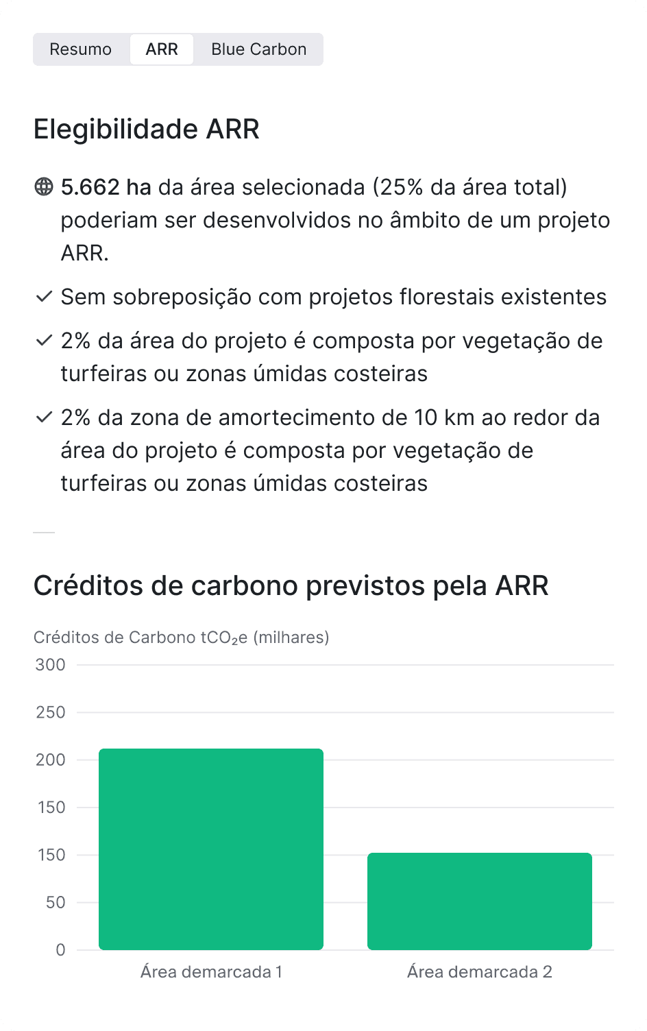
Potential analysis, continuous MRV, and automated document design on a single platform. Compatible with Verra VCS, Gold Standard, Social Carbon, and Plan Vivo.
Potential analysis, continuous MRV, and automated document design on a single platform. Compatible with Verra VCS, Gold Standard, Social Carbon, and Plan Vivo.
From feasibility to issued credit
Potential analysis, continuous MRV, and automated document design on a single platform. Compatible with Verra VCS, Gold Standard, Social Carbon, and Plan Vivo.

Audit-grade evidence for carbon
Audit-grade evidence for carbon
Centralized monitoring, reporting, and verification with deforestation, wildfire, and encroachment data. Interactive dashboards and transparency for audits, investors, and regulators.
Audit-grade evidence for carbon
Centralized monitoring, reporting, and verification with deforestation, wildfire, and encroachment data. Interactive dashboards and transparency for audits, investors, and regulators.
"What used to require 4 technicians and 2 weeks of work is now resolved in minutes. Over R$80,000 saved in technical team costs in a single analysis."

Roberto Silva, PhD.
Sustainability Manager
Talk to a NOR Space specialist
Talk to a NOR Space specialist
Talk to a NOR Space specialist
Discover how NOR Space is revolutionizing spatial intelligence.
Discover how NOR Space Intelligence is revolutionizing spatial intelligence.
Discover how NOR Space is revolutionizing spatial intelligence.
Blog posts
Defesa & Segurança Nacional
Category 2
From Image to Decision: The Window That Defines Defense Spatial Intelligence
Title
High-resolution satellite imagery is now the foundation of modern reconnaissance, surveillance, and decision support capabilities in defense operations, without depending on manned aerial platforms or physical presence in a risk area. In Brazil, the Brazilian Air Force (FAB) has autonomously operated the Lessonia X39 and X43 SAR satellites since March 2025, through the Space Operations Center in Brasília — a concrete step toward spatial intelligence sovereignty. The remaining challenge is no longer capturing the image. It’s turning it into operational intelligence within the window that still matters for the decision.
What separates intelligence from archived data
What determines whether an orbital image becomes useful intelligence for a defense operation, rather than data that arrives too late to matter, is the combination of three properties that are rarely described together. The first is the gap between the need and the delivered image: a manual tasking flow, without automated orchestration across constellations, tends to accumulate latency incompatible with rapid-response operations — a problem that multi-constellation API orchestration architectures reduce significantly. The second is the quality of the analysis, because a high-resolution image delivered on time still generates little value if it requires hours of manual review before becoming actionable intelligence — a bottleneck that computer vision with multispectral and SAR fusion shifts from the order of hours to minutes. The third, less discussed, is decision traceability: every action taken based on orbital data must carry a documented owner, date, and justification, because without that record the chain of command has no way to audit the operation after the fact.
Imagery is raw material. Intelligence is the product. The distance between the two is exactly what a defense architecture needs to close.
SAR and optical don’t compete, they complement each other
For military operations, sensor choice defines what can be detected and under what conditions. Sub-meter resolution optical imagery delivers fine visual detail, identifying vehicles, vessels, infrastructure, and movement patterns, but has a limitation that no resolution improvement solves: clouds, smoke, and darkness block the signal completely. SAR attacks exactly that blind spot, penetrating clouds and smoke and operating at night, as demonstrated in the FAB operation on Marajó Island in June 2025, when SAR-equipped aircraft detected a camouflaged naval structure and an atypical logistics pattern on an Amazon river — precisely the kind of scene optical imagery wouldn’t cover under tropical cloud cover.
An architecture that produces consistent intelligence combines both sensors — optical for detailed visual identification and SAR for continuous coverage regardless of weather conditions — because neither is sufficient alone in a real operational environment.
Data sovereignty starts with processing infrastructure
For any defense or intelligence operation, where the data is processed defines who has access to it. A foreign image-analysis platform, however efficient, subjects operational data to another country’s jurisdiction, and the 2018 US CLOUD Act makes that exposure concrete by authorizing US authorities to access data from American companies regardless of where it’s hosted — a condition incompatible with the basic requirement of sovereign intelligence. That’s why the FAB took autonomous control of the Lessonia satellites in March 2025: data sovereignty starts with control of the processing infrastructure, not just the orbital platform.
How NOR Defence Intelligence closes that loop
NOR Defence Intelligence was developed to reduce the gap between orbital data acquisition and operational decision-making, integrating acquisition, processing, analysis, and command into a single ecosystem, with the same underlying principle: the entire architecture runs on national infrastructure, which preserves control over strategic information and removes external dependency at critical stages of the flow.
Four modules support this integration. SENTINEL Tasking automatically orchestrates multiple constellations via API, evaluating in real time factors such as availability, pass window over the area of interest, forecast cloud cover, and the sensor type best suited to the mission, significantly reducing the latency between request and delivery. SAI Analysis applies computer vision with SAR and optical image fusion to automatically identify vessels, aircraft, vehicles, sensitive infrastructure, and occupancy changes in monitored areas, shifting initial triage from hours to minutes and freeing analysts to validate and interpret the most relevant events. ORBIT Planning calculates the best acquisition window for each area of interest considering variables such as solar elevation, viewing angle, and forecast cloud cover, scheduling each collection for the moment of highest probability of useful data. And NEXUS Command centralizes decisions, tasks, and evidence in a single interface, automatically logging the owner, date, operational justification, and history of each action, creating an auditable digital chain from the collection request to the final decision.
An architecture oriented toward technological sovereignty
Beyond operational functionality, NOR Defence Intelligence was designed to meet the security requirements of strategic operations: the entire stack runs on national infrastructure, with no dependency on foreign vendors for critical functions. The solution adopts a dual-use positioning, with priority application in civil and government operations, ITAR/EAR-friendly compatibility, and no components related to weapons systems, delivering a technology foundation for spatial intelligence focused on monitoring, surveillance, planning, and decision support, while preserving operational autonomy and data sovereignty.

Defesa & Segurança Nacional
6 de jul. de 2026
From Image to Decision: The Window That Defines Defense Spatial Intelligence
From Image to Decision: The Window That Defines Defense Spatial Intelligence
Defesa & Segurança Nacional
6 de jul. de 2026
From Image to Decision: The Window That Defines Defense Spatial Intelligence
From Image to Decision: The Window That Defines Defense Spatial Intelligence

Riscos Ambientais, ESG & Compliance
6 de jul. de 2026
Auditing Claims and Environmental Damage via Satellite: How Orbital Imagery Changes the Weight of Evidence
Auditing Claims and Environmental Damage via Satellite: How Orbital Imagery Changes the Weight of Evidence

Gasodutos & Oleodutos
6 de jul. de 2026
SAR-Based Landslide Monitoring: How Interferometry Detects Movement Before Collapse
SAR-Based Landslide Monitoring: How Interferometry Detects Movement Before Collapse

Riscos Ambientais, ESG & Compliance
6 de jul. de 2026
Predictive Satellite Monitoring of Operational Risk: How to Anticipate Failures Before They Become Liabilities
Predictive Satellite Monitoring of Operational Risk: How to Anticipate Failures Before They Become Liabilities

Riscos Ambientais, ESG & Compliance
1 de jul. de 2026
Triaging Environmental Alerts with Artificial Intelligence: Turning Volume Into Decisions
Triaging Environmental Alerts with Artificial Intelligence: Turning Volume Into Decisions

Core Tech
1 de jul. de 2026
Computer Vision Applied to Satellite Imagery: How Machines Learn to See the Land
Computer Vision Applied to Satellite Imagery: How Machines Learn to See the Land

Core Tech
26 de jun. de 2026
Right-of-Way Monitoring by Satellite: The Case With 94% Vegetation-Clearing Detection
Right-of-Way Monitoring by Satellite: The Case With 94% Vegetation-Clearing Detection

Riscos Ambientais, ESG & Compliance
26 de jun. de 2026
Land Asset Monitoring in Mining: What Orbital Data Solves That Traditional Methods Can't
Land Asset Monitoring in Mining: What Orbital Data Solves That Traditional Methods Can't

Core Tech
26 de jun. de 2026
Spatial Intelligence: What Changes When an Image Becomes an Operational Alert
Spatial Intelligence: What Changes When an Image Becomes an Operational Alert

Riscos Ambientais, ESG & Compliance
20 de mai. de 2026
Data Sovereignty and Lock-In-Free Integration: Why Critical Infrastructure Can't Depend on a Foreign Vendor
Data Sovereignty and Lock-In-Free Integration: Why Critical Infrastructure Can't Depend on a Foreign Vendor
Blog posts
Defesa & Segurança Nacional
From Image to Decision: The Window That Defines Defense Spatial Intelligence
High-resolution satellite imagery is now the foundation of modern reconnaissance, surveillance, and decision support capabilities in defense operations, without depending on manned aerial platforms or physical presence in a risk area. In Brazil, the Brazilian Air Force (FAB) has autonomously operated the Lessonia X39 and X43 SAR satellites since March 2025, through the Space Operations Center in Brasília — a concrete step toward spatial intelligence sovereignty. The remaining challenge is no longer capturing the image. It’s turning it into operational intelligence within the window that still matters for the decision.
What separates intelligence from archived data
What determines whether an orbital image becomes useful intelligence for a defense operation, rather than data that arrives too late to matter, is the combination of three properties that are rarely described together. The first is the gap between the need and the delivered image: a manual tasking flow, without automated orchestration across constellations, tends to accumulate latency incompatible with rapid-response operations — a problem that multi-constellation API orchestration architectures reduce significantly. The second is the quality of the analysis, because a high-resolution image delivered on time still generates little value if it requires hours of manual review before becoming actionable intelligence — a bottleneck that computer vision with multispectral and SAR fusion shifts from the order of hours to minutes. The third, less discussed, is decision traceability: every action taken based on orbital data must carry a documented owner, date, and justification, because without that record the chain of command has no way to audit the operation after the fact.
Imagery is raw material. Intelligence is the product. The distance between the two is exactly what a defense architecture needs to close.
SAR and optical don’t compete, they complement each other
For military operations, sensor choice defines what can be detected and under what conditions. Sub-meter resolution optical imagery delivers fine visual detail, identifying vehicles, vessels, infrastructure, and movement patterns, but has a limitation that no resolution improvement solves: clouds, smoke, and darkness block the signal completely. SAR attacks exactly that blind spot, penetrating clouds and smoke and operating at night, as demonstrated in the FAB operation on Marajó Island in June 2025, when SAR-equipped aircraft detected a camouflaged naval structure and an atypical logistics pattern on an Amazon river — precisely the kind of scene optical imagery wouldn’t cover under tropical cloud cover.
An architecture that produces consistent intelligence combines both sensors — optical for detailed visual identification and SAR for continuous coverage regardless of weather conditions — because neither is sufficient alone in a real operational environment.
Data sovereignty starts with processing infrastructure
For any defense or intelligence operation, where the data is processed defines who has access to it. A foreign image-analysis platform, however efficient, subjects operational data to another country’s jurisdiction, and the 2018 US CLOUD Act makes that exposure concrete by authorizing US authorities to access data from American companies regardless of where it’s hosted — a condition incompatible with the basic requirement of sovereign intelligence. That’s why the FAB took autonomous control of the Lessonia satellites in March 2025: data sovereignty starts with control of the processing infrastructure, not just the orbital platform.
How NOR Defence Intelligence closes that loop
NOR Defence Intelligence was developed to reduce the gap between orbital data acquisition and operational decision-making, integrating acquisition, processing, analysis, and command into a single ecosystem, with the same underlying principle: the entire architecture runs on national infrastructure, which preserves control over strategic information and removes external dependency at critical stages of the flow.
Four modules support this integration. SENTINEL Tasking automatically orchestrates multiple constellations via API, evaluating in real time factors such as availability, pass window over the area of interest, forecast cloud cover, and the sensor type best suited to the mission, significantly reducing the latency between request and delivery. SAI Analysis applies computer vision with SAR and optical image fusion to automatically identify vessels, aircraft, vehicles, sensitive infrastructure, and occupancy changes in monitored areas, shifting initial triage from hours to minutes and freeing analysts to validate and interpret the most relevant events. ORBIT Planning calculates the best acquisition window for each area of interest considering variables such as solar elevation, viewing angle, and forecast cloud cover, scheduling each collection for the moment of highest probability of useful data. And NEXUS Command centralizes decisions, tasks, and evidence in a single interface, automatically logging the owner, date, operational justification, and history of each action, creating an auditable digital chain from the collection request to the final decision.
An architecture oriented toward technological sovereignty
Beyond operational functionality, NOR Defence Intelligence was designed to meet the security requirements of strategic operations: the entire stack runs on national infrastructure, with no dependency on foreign vendors for critical functions. The solution adopts a dual-use positioning, with priority application in civil and government operations, ITAR/EAR-friendly compatibility, and no components related to weapons systems, delivering a technology foundation for spatial intelligence focused on monitoring, surveillance, planning, and decision support, while preserving operational autonomy and data sovereignty.
Defesa & Segurança Nacional
6 de jul. de 2026
From Image to Decision: The Window That Defines Defense Spatial Intelligence
From Image to Decision: The Window That Defines Defense Spatial Intelligence
Defesa & Segurança Nacional
6 de jul. de 2026
From Image to Decision: The Window That Defines Defense Spatial Intelligence
From Image to Decision: The Window That Defines Defense Spatial Intelligence
Riscos Ambientais, ESG & Compliance
6 de jul. de 2026
Auditing Claims and Environmental Damage via Satellite: How Orbital Imagery Changes the Weight of Evidence
Auditing Claims and Environmental Damage via Satellite: How Orbital Imagery Changes the Weight of Evidence
Gasodutos & Oleodutos
6 de jul. de 2026
SAR-Based Landslide Monitoring: How Interferometry Detects Movement Before Collapse
SAR-Based Landslide Monitoring: How Interferometry Detects Movement Before Collapse
Riscos Ambientais, ESG & Compliance
6 de jul. de 2026
Predictive Satellite Monitoring of Operational Risk: How to Anticipate Failures Before They Become Liabilities
Predictive Satellite Monitoring of Operational Risk: How to Anticipate Failures Before They Become Liabilities
Riscos Ambientais, ESG & Compliance
1 de jul. de 2026
Triaging Environmental Alerts with Artificial Intelligence: Turning Volume Into Decisions
Triaging Environmental Alerts with Artificial Intelligence: Turning Volume Into Decisions
Core Tech
1 de jul. de 2026
Computer Vision Applied to Satellite Imagery: How Machines Learn to See the Land
Computer Vision Applied to Satellite Imagery: How Machines Learn to See the Land
Core Tech
26 de jun. de 2026
Right-of-Way Monitoring by Satellite: The Case With 94% Vegetation-Clearing Detection
Right-of-Way Monitoring by Satellite: The Case With 94% Vegetation-Clearing Detection
Riscos Ambientais, ESG & Compliance
26 de jun. de 2026
Land Asset Monitoring in Mining: What Orbital Data Solves That Traditional Methods Can't
Land Asset Monitoring in Mining: What Orbital Data Solves That Traditional Methods Can't
Core Tech
26 de jun. de 2026
Spatial Intelligence: What Changes When an Image Becomes an Operational Alert
Spatial Intelligence: What Changes When an Image Becomes an Operational Alert
Riscos Ambientais, ESG & Compliance
20 de mai. de 2026
Data Sovereignty and Lock-In-Free Integration: Why Critical Infrastructure Can't Depend on a Foreign Vendor
Data Sovereignty and Lock-In-Free Integration: Why Critical Infrastructure Can't Depend on a Foreign Vendor

Ready to transform your data
Ready to transform your data
into
into
intelligence?
intelligence?